
What a Georgetown Neighbors Search Can Show
Public records can describe the parcels around a Georgetown address, the owners shown on appraisal cards, a deed’s legal description, and the association or municipal layers that affect an area. They do not supply a complete household census. The practical question is therefore narrow: which nearby parcel or block fact does a source document, and what does it leave unanswered? Start with a map and retain an independent source date for each property rather than treating one result as a definitive list of nearby people.
| Block source | What it documents nearby | Access and limit |
|---|---|---|
| Williamson GIS | Address result, parcel shape, jurisdiction, districts, and map orientation. | Free address and map route; live popup fields were not captured. |
| Georgetown GIS | Parcels, city limits, ETJ, planning, utility, code, and public-safety context. | Free layer services; fields and dates vary by layer. |
| WCAD | Owner, mailing and situs address, legal description, value, exemptions, and sales history. | Free card-by-card search; it is not a household census. |
| County deed index | Conveyances and legal descriptions for adjoining lots. | Index, counter, or request route; online historical cutoff is not stated. |
| Voter lookup or file | Individual registration or precinct information where law permits. | No public block browse was confirmed; protected-voter rules apply. |
| HOA or neighborhood layer | Association boundary and name. | Public boundary context, not a member directory. |
For a property question, a parcel owner and a current occupant are not interchangeable. A WCAD mailing address can differ from its situs address; an exemption can be a tax clue, not a roster; and a voter or directory entry has its own date and rules.
Begin a Georgetown Neighbors Search With County GIS
The Williamson County GIS address lookup uses one autocomplete field with the instruction to enter an address and choose it from the dropdown. Its example format is “710 S Main St or Main St.” Select the official suggestion before deciding whether the address sits in the city, its ETJ, or another county jurisdiction. The county maps page also supports street or address searching, district boundaries, and print or export functions.
Georgetown’s city GIS provides a second layer of context. Public service folders include parcels, planning, public safety, parks, and code enforcement; the economic-development reference map includes city limits, ETJ, utility providers, and parcels. That distinction matters because a Georgetown mailing address or ZIP code can extend beyond the incorporated city. Use the map result to orient the block, then use the appraisal district for the ownership record.
The county address lookup is the appropriate first screen for this task because it ties the typed address to a jurisdiction and map setting before any conclusion about a nearby parcel.
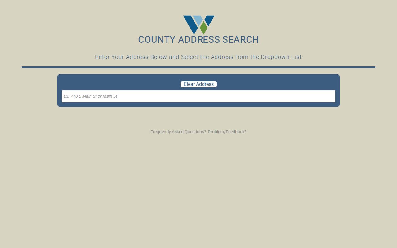
Read the selected suggestion as an orientation result, then save the parcel key or legal description where the viewer supplies one and continue to WCAD separately.
Map Adjacent Georgetown Parcels One at a Time
A block-level workflow works outward from a single verified address. County GIS is the orientation layer, WCAD is the appraisal layer, and city GIS can clarify municipal boundaries and nearby planning or service context. The research did not confirm a dedicated radius, buffer, or identify-all control in the current viewers, so the safe method is to inspect neighboring polygons individually instead of claiming an automated neighbor list.
- Locate the target address in county or Georgetown GIS and select the official address result.
- Zoom until the target parcel outline and the street segment are clear, then click or pan to each adjoining parcel where the map allows it.
- Copy a map, account, or legal-description key for each parcel, plus the source date and jurisdiction context.
- Open each key in WCAD Advanced Search to inspect the individual public property card.
- Use the County Clerk index for a transfer or legal-description question, recording each instrument as an independent source.
For a whole named street rather than the immediate block, use the Georgetown by-street directory. The block method is limited to parcels that touch or sit directly around one address.
WCAD Separates Parcel Owners From Occupants
WCAD Advanced Search accepts street number range, street name, city, ZIP code, neighborhood, property type, property status, tax year, owner or business name, property or CAD ID, legal description, abstract or subdivision, block, tract or lot, and acreage. A result can reveal the parcel’s owner, mailing address, situs address, legal description, map number, exemptions, value history, improvements, land segments, and sales history. That is a detailed property record, not proof of every person living on the block.
Use the legal description, not only a street label, when checking adjacent lots. A legal description can bridge a parcel card to a deed, a plat, or an older addition. The physical situs shows where the parcel is; the mailing address shows where tax correspondence goes. The difference is essential when researching Georgetown parcels responsibly.
The WCAD Advanced Search form shows the parcel, address, owner, legal-description, subdivision, and tax-year fields that support an individual block parcel check.
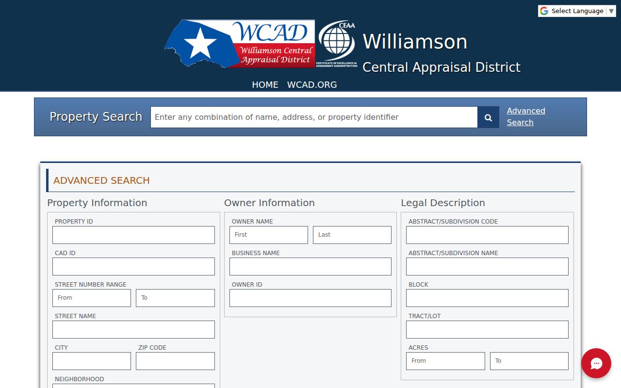
Use the form one parcel at a time and retain its source date. The display describes an appraisal record, not a roster of the people who occupy nearby homes.
Williamson County’s Property Fraud Alert page describes free email or telephone alerts when a land-record document is recorded under a subscribed name. It is a protective notification service, not a historical ownership database.
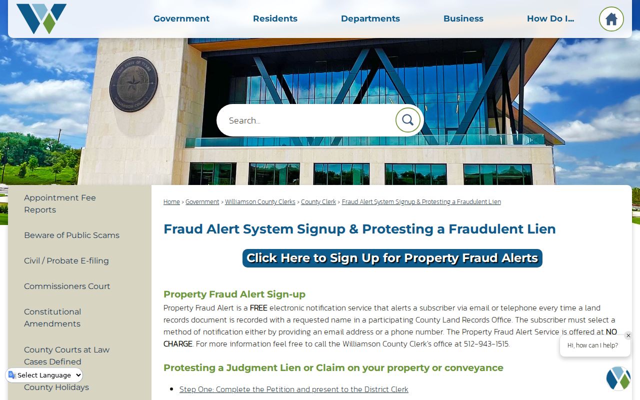
The alert service is most useful as a way to distinguish a real county recording notice from an unrelated solicitation, while parcel history still requires WCAD and recorded documents.
Note: A homestead or exemption field can be a context clue, but it does not identify every household member or confirm occupancy.
Why Voter Search Is Not a Georgetown Block Directory
Williamson County’s voter lookup and the statewide VoteTexas route are person-oriented. The inspected public path did not show a public all-voters-on-this-street or all-voters-on-this-block search. County training material describes name, county, VUID, date-of-birth, and Texas driver-license search routes, but the exact public form sequence was not captured. A result may speak to registration or precinct, not to a complete current household.
Texas does not register voters by party, and ballot choices are secret. A lawful voter-file request can be subject to the Texas Public Information Act, fees, and restrictions. The Williamson opt-out form removes website and SOS display but does not erase the official record from all lawful access. Protected participants must remain protected: Texas ACP voters can show a public name with asterisks in place of the residence address, and the actual residence must not be pursued.
Note: An absent online voter result can reflect a format issue, an inactive or protected record, or a portal limitation rather than a conclusion about a person.
Community Names Around Georgetown
Georgetown’s HOA GIS legend is a community-context tool. Its registered names include Berry Creek HOA, Georgetown Village, Heritage Oaks, Old Town Neighborhood Association, Sun City Community Association, University Park HOA, Water Oak at San Gabriel, and Westhaven, among others. The same legend also lists an “unregistered” category, including names such as Casa Loma, Crystal Knoll Terraces, Georgetown Crossing, Pecan Branch North, and Windridge. That label is the map layer’s category, not a legal conclusion about whether an association exists.
City HOA GIS
Shows association boundary and name layers, with attributes including HOA_Name and map metadata.
Texas certificate search
Filters management certificates by association name, county, city, or ZIP and can provide management-contact evidence.
Sun City directory
Lists neighborhood sections and representative structure, but does not publish a general member roster.
The City HOA legend is valuable for a boundary name and an association lead. It does not identify residents or turn a subdivision into a public directory.
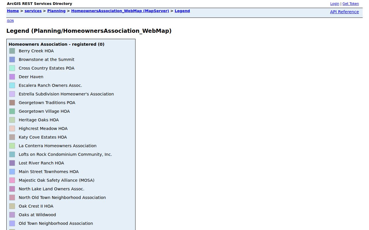
Use the legend to describe the community layer around a parcel, then seek association information through the relevant public management or organization channel rather than inferring member identities.
Sun City Gives a Neighborhood Structure, Not a Roster
Sun City Texas publicly identifies neighborhood sections 01 through 97, with gaps and variants such as 14A, 16C, and 24A, B1, and B2. Its Neighborhood Representative Organization materials describe a representative, alternate, and block captains for each neighborhood, and more than 85 neighborhoods are described in that public structure. Some pages are marked “coming soon.” This is useful context for a neighborhood’s organization, not evidence about every household or person within it.
A 2023 Sun City Firewise filing reported 9,241 homes, an estimated 17,096 residents, 79 of 90 planned neighborhoods, and five Firewise areas within its stated Georgetown community context. These are association-level figures from a dated document, not a public parcel count and not a list of area residents. They show why a community layer can be informative without replacing parcel-by-parcel research.
Georgetown Cemetery Parcels Are a Different Map Layer
Georgetown’s public cemetery feature service can be searched for plot geography and includes fields for purchaser name and sales address, burial name, dates of birth, death, and interment, as well as status values such as Burial, Reserved, and Available. It can connect a person, a plot, and a historical address-like lead. It is not a residential-block map, and a reserved plot or purchaser address must never be used as proof of residence.
The City cemetery plot service shows the kinds of data that are present in this specialized layer, including addition, block, lot, subdivision, space, and interment fields.
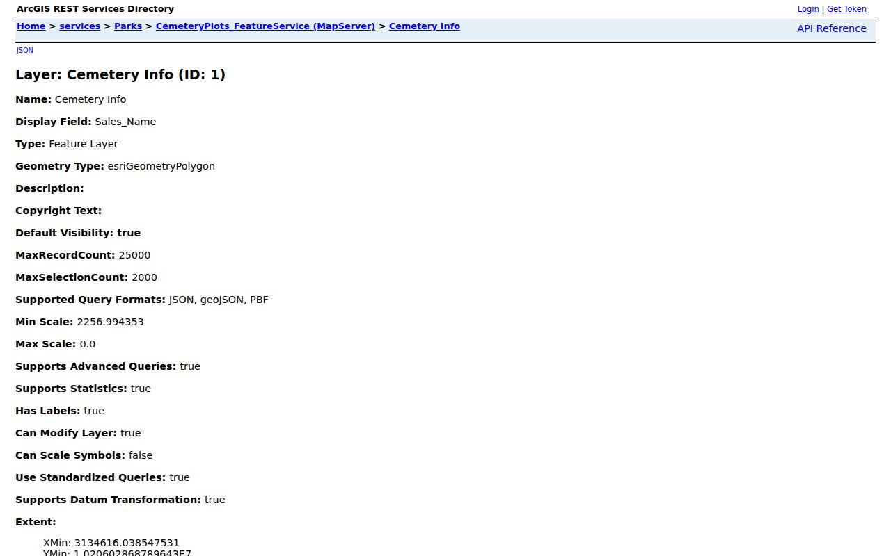
A cemetery result may support family-history or obituary work, but it should be kept separate from the current residential parcel trail.
Official Records and Commercial Neighbor Tools Are Not the Same
Official records identify the custodian, record purpose, and access limits. Commercial people-search products, as a category, may combine property, marketing, court, voter, licensing, and other material. Their results can be stale, can combine people with similar names, and can omit protected participants. Use a source record and access date as the basis for a neighborhood question, then ask the office holding that record about correction or access procedures.
| Official map and appraisal records | Give parcel, jurisdiction, and owner-related property facts with a named public custodian and field limits. |
|---|---|
| Recorded deed and county files | Document a particular instrument or public portion of a county record, with counter and request fallbacks when the web route is incomplete. |
| Commercial category results | Can offer leads, but may have accuracy, identity-match, recency, and opt-out limits that must not override an official source. |
Privacy Boundaries for Georgetown Neighbor Research
Texas public-record access has field-by-field limits. The Texas Address Confidentiality Program provides qualifying participants a substitute mailing route, and voter ACP records keep the actual residence, Social Security number, and Texas driver-license or ID information confidential. The federal Driver’s Privacy Protection Act restricts personal information from motor-vehicle records. Other occupants, household members, utility customers, delivery customers, protected residents, and nonpublic identifying information should not be treated as a public block dataset.
If an official entry is wrong, take the exact record number, field, and supporting evidence to the custodian that holds it: WCAD for a property-card issue, Elections for voter status or address, the County Clerk for a deed-index matter, or the relevant city or county records office for its own file. One office cannot correct another office’s record.
Lawful use. Georgetown neighbor research can support neighborhood curiosity, family connections, and personal safety awareness. Do not use public records to watch, threaten, harass, intimidate, or expose anyone, and never attempt to uncover a protected address.