
Finding Georgetown Addresses by Street
Begin a Georgetown street directory search with the Williamson County GIS address tool. Select its suggested address, note the jurisdiction, then carry the street, number, parcel, and legal-description clues to WCAD. A WCAD card can identify the assessed owner, the situs address, a tax correspondence address, account identifiers, sales history, and property characteristics. That is a parcel trail, not a complete list of occupants. The owner, mailing recipient, voter, and resident may be different people or entities.
Use the address trail in sequence. The GIS result or map orients the street. WCAD gives appraisal and ownership keys. The County Clerk index can connect a sale-history lead to a recorded instrument. A voter lookup can only confirm a person through its public, person-oriented route, and an older criss-cross directory can offer an address-to-occupant lead where a volume exists.
- Enter the address in County GIS, choose the matching suggestion, and record the jurisdiction and map context.
- Use WCAD with the street number range, street name, city, or ZIP field to locate the parcel and save the account and legal description.
- Read the parcel's sales history, then use the owner, seller, buyer, date, legal description, or instrument reference in the Clerk's deed route.
- Check an individual through the voter lookup only when a public match is appropriate. The research found no public one-click roster for all voters on a street.
- For a historical household, test the same address in a verified reverse directory or a library and TSLAC collection, then cross-check the date.
Browse Georgetown Streets in WCAD
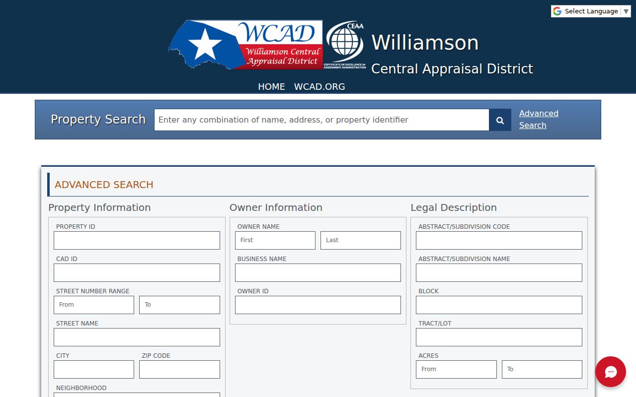
WCAD Advanced Search supports a real street-by-street method. It offers Street Number Range with from and to boxes, Street Name, City, ZIP Code, Neighborhood, Property Type, Property Status, Tax Year, owner and business-name fields, property or CAD IDs, legal description, subdivision code or name, block, tract or lot, and acreage. The interface did not mark the captured fields as required, and status and tax-year choices are dynamic. A whole-street query should be narrowed slowly, because no result cap or export behavior was documented in the research.
| WCAD search field | Street-directory use | Observed condition |
|---|---|---|
| Street Number Range | Limit a search to a segment | Two optional text boxes |
| Street Name and City | Find a Georgetown road in the appraisal roll | Optional text fields |
| ZIP Code and Neighborhood | Narrow a broad street result | Optional filters |
| Legal Description and Block | Bridge a street number to deed language | Optional text fields |
| Property Type and Tax Year | Refine result set and context | Dynamic options |
The WCAD Advanced Search form shows the property, address, owner, and legal-description filters available for a Georgetown street directory search.
After opening a result, keep the situs and mailing addresses separate. The situs is the physical tax parcel. The mailing address is where tax correspondence goes and does not establish occupancy.
Map Georgetown Street Jurisdiction
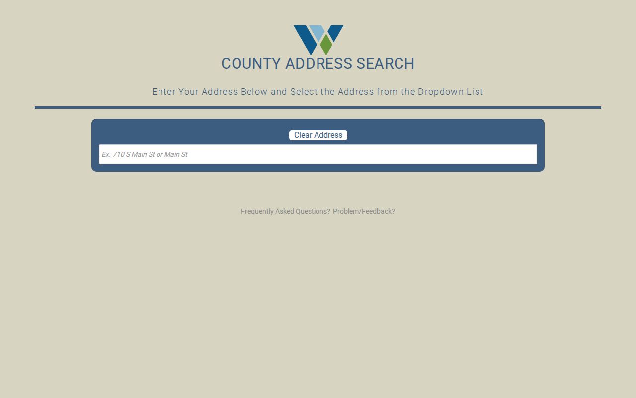
The Williamson County GIS address lookup is a single autocomplete field with the instruction to enter an address and select it from the dropdown. Its example uses a numbered street or street name, and Clear Address resets the field. County map tools also support street or address search, district viewing, and print or export. The city GIS service adds parcels, city limits, the ETJ, public safety, parks, planning, code, and utility context. Its role is map orientation, not a countywide owner-name search.
This County GIS address screen is the first geographic check before a Georgetown street directory search moves into appraisal or Clerk records.
Georgetown postal addresses can fall in the city, its ETJ, or unincorporated county territory. The jurisdiction result helps avoid requesting a city file when a county custodian holds the record.
Georgetown Street Records by Address
Street records use different keys. GIS begins with a current address and jurisdiction. WCAD supplies a situs, account number, legal description, owner and sale history. The Clerk's index follows a grantor, grantee, instrument, or legal-description trail. City GIS and permit routes can show case or infrastructure context. Historical directories and census schedules give dated household snapshots where accessible. None alone identifies every person who lived at a number.
| Record Set | Keeper | What It Shows | Access |
|---|---|---|---|
| WCAD parcel card | Williamson CAD | Owner, situs, mailing, value, legal description, sales history | Free public search |
| County GIS address map | Williamson County GIS | Address suggestion, jurisdiction, and map context | Free web lookup |
| Recorded deed and index | Williamson County Clerk | Grantor, grantee, instrument, date, and legal description | Portal, counter, or request |
| City GIS and permits | City of Georgetown | City limits, ETJ, planning, development, and case context | Public services or request |
| Reverse directory | Library or TSLAC | Historical address-to-occupant lead where printed | Exact local run unconfirmed |
A parcel number and legal description connect the tax card to deeds and plats more reliably than a street name alone. The voter lookup may be one separate individual check, but the research did not find public block browsing. For a historical name and address question, the Georgetown city directories collection gives the archive-focused method instead of repeating it here.
Follow Georgetown Deeds From WCAD
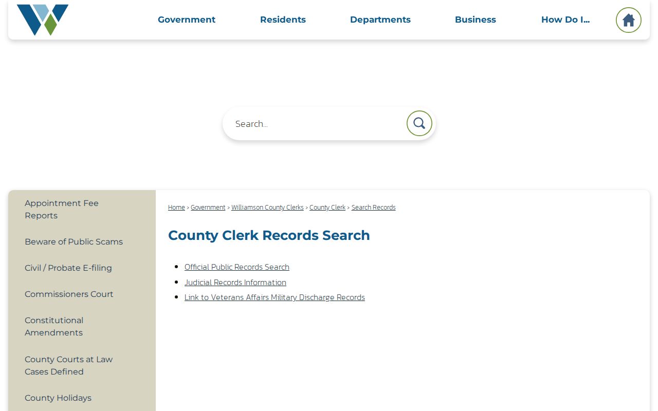
When WCAD sales history identifies a transfer, carry the current owner, seller, buyer, sale date, instrument number, and legal description to the County Clerk's record route. The County search hub links official-records paths. The alternate Kofile shell lists grantor or grantee, subdivision, document type, document number, recorded-date controls, and index-only or OCR full-text modes. The observed portal state did not produce a dependable result row, so its online start date and image availability are not known.
The Williamson County record-search page shows the county's official record routes, including deed-index paths.
A grantor transfers an interest, while a grantee receives it. Search a current owner as grantee to locate the purchase deed, then use the seller as the next historic lead. A recorded party is not automatically an occupant of the street address.
Use Georgetown Cases to Date Addresses
Georgetown's development-pipeline GIS service exposes CASE_NAME, DateText, and a Case_Link or MGO link. Its right-of-way permit layer includes types such as Electric, Fiber, Gas, Storage, Water, and Other. These are useful when a street search needs context about a development case, alteration, or nearby infrastructure work. The service did not state an archive beginning year, and the MGO permit portal's field inventory was not captured. A permit applicant is not necessarily the resident or owner.
Older street work also benefits from the city's original geography. Georgetown's 1848 plan had a 52-block grid around a public square, and Glasscock Addition dates to 1854. A lot, block, subdivision, survey, or abstract may survive when a modern street number does not. A plat is the recorded layout of land, and it can explain how a street address relates to a deed's legal description.
- Parcel
- A defined tract in the appraisal system, normally connected to a WCAD account or property ID.
- Situs address
- The physical location used on the tax card, distinct from a correspondence address.
- Plat
- A recorded map showing a subdivision, roads, blocks, lots, or other land layout.
- Criss-cross directory
- A directory arranged by address so an available historical volume can offer an occupant lead.
Protect Georgetown Recording Names
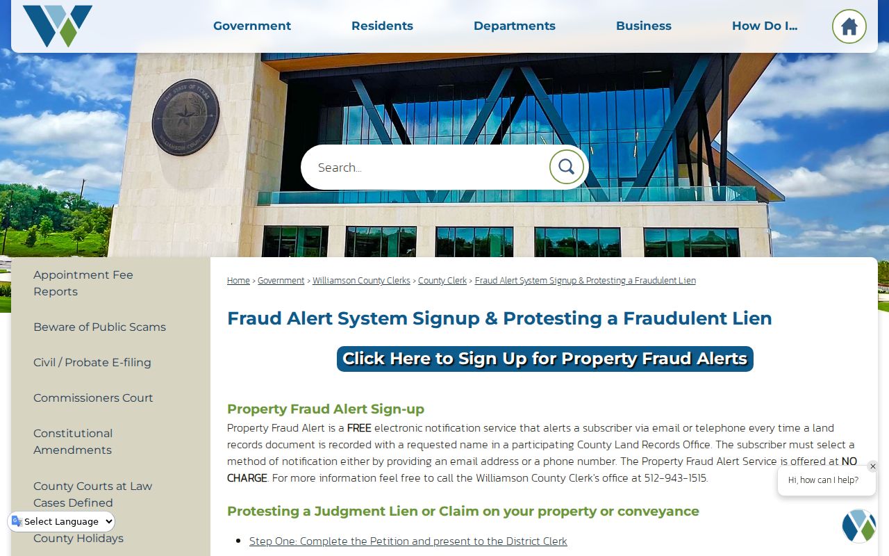
Williamson County offers a free Property Fraud Alert that sends email or telephone alerts when a land-record document is recorded under a subscribed name. It is a notice service, not a deed-history database and not a way to expose address information. The county also describes an affidavit and District Clerk petition route for a fraudulent lien or judgment, followed by judge review and no-charge filing of a certified order with the County Clerk.
The county fraud-alert screen shows the official safety service attached to local recording records.
Public-record searching should preserve the difference between a recorded name and a current household. Report a suspected fraudulent filing through the county process instead of relying on a private solicitation.
Read Georgetown Addresses in Reverse
A reverse or criss-cross directory is the historical version of a street directory. When a volume includes a street section, an address may lead to an occupant name, telephone, spouse, occupation, or other printed detail. TSLAC explains the general format and holds city directories in its Austin Reference Reading Room. The Georgetown Public Library's Texas History Room, Williamson County Genealogical Society, and Preservation Georgetown are local routes for checking what is available. Exact Georgetown directory titles and years were not confirmed in the accessible official sources.
Pair each directory result with its publication year, a census release year, deed date, or newspaper reference. An old listing is useful as a dated lead, not a claim about a current resident. This historic method becomes especially valuable when an old deed uses lot, block, survey, or addition language instead of a modern street number.
Keep Georgetown Street Dates Together
Address evidence is strongest when every record is dated. A WCAD card reflects an appraisal and tax context. A recorded instrument has execution or recording information. A city development layer can include a case date, while a directory or census is a snapshot of its own period. Georgetown's 1848 grid, its 1854 Glasscock Addition, and later railroad-era change make a legal description and map context important for older addresses. The research found no verified street-renumbering year, so do not force an old address into a modern number without a matching lot, block, or survey clue.
Note: County maps reported precinct changes effective in 2026, so historical election or district context should be tied to the relevant date rather than assumed current.
Limits of a Georgetown Street Directory
A Georgetown street directory cannot reveal every household. WCAD is an owner and tax record, not an occupancy census. Its mailing address may be different from the parcel. The observed voter lookup has no public all-voters-on-a-street browse, and protected voters can have limited display. Driver-license address information is restricted under the federal Driver's Privacy Protection Act. Utility, delivery, and private customer lists are not public street records. A missing result may reflect an address format, a protected record, a different jurisdiction, or a historical coverage gap.
Texas Address Confidentiality Program participants can use a substitute mailing address, and protected voter residence details should never be reversed or republished. Court, vital, juvenile, sealed, and expunged records also have record-specific limits. For a current person check, use only the public portion of the correct custodian's record and distinguish owner, mailing addressee, voter, and occupant roles.
When an address trail stops, preserve the last verified account, legal description, map context, and date. Then move to the appropriate archive or custodian rather than filling the gap with an assumption. TSLAC identifies historical Williamson deed books and indexes from 1848, while the library and archival collections can provide dated directory, map, and census leads. Those sources may explain an older address without turning it into a present-day household claim.
TSLAC records two useful directions for an older street search: direct deed indexes organize a name as a grantor or grantee, while reverse indexes can support the opposite party path. Its guide lists direct indexes beginning in 1848 and reverse indexes beginning in 1848, plus later reel groups. Historical tax rolls from 1848 through 1910 can show property presence in a given year, though their address descriptions may change. The May 1916 Georgetown Sanborn set supplies six sheets of building and block context, not a list of people.
Lawful use. Georgetown street records support personal, civic, family-history, and property research. Do not use any result to stalk, harass, intimidate, or harm another person.